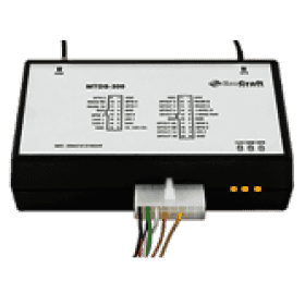
MTDS-300 GPS / GSM terminals are used in transportation programming and control. With the help of real-time satellite navigation device, it determines the geographical coordinates of the object with the specified frequency and sends them to the server for further analysis and presentation to the user. Data delivery to the server is done through the GSM / GPRS network. In addition to navigation information, MTDS-300 also contains other data on the object being monitored. For example, the terminal is connected to level sensors and fuel consumption. The built-in CAN interface allows you to connect MTDS-300 to the vehicle's CAN bus and read information about various vehicle systems parameters, fuel consumption, engine speed, axle load. For some car brands, remote diagnostics through the CAN bus is possible with MTDS-300. Most of the MTDS-300 firmware - MTDS firmware - is available as open source. This allows integrators and operators to adapt the GPS / GSM terminal monitoring functionality to meet their specific needs.

 ES
ES
 PT
PT